


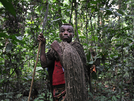
A Mbuti man sets out to hunt in the Congo Basin rain forest.
Many Americans use global positioning system (GPS) technology to find a weekend party or to avoid highway congestion. In the rain forest of central Africa’s vast Congo Basin, however, the indigenous people who call the forest home are using GPS to save their own lives.
Some 40 million people live in the Congo Basin, which lies mostly within the Democratic Republic of the Congo. Among them are half a million indigenous people, often called pygmies, who live by hunting and gathering. Although these peoples have lived in the forest for millennia, the state owns the land, and the people have few rights to control what happens there. So, when logging or mining companies want to reap wealth from the region, the government often lets them in, and the local people may be shut out of the forest that supports them.
Now, a group called Rainforest Foundation UK is providing GPS devices to the forest dwellers. With GPS, the people create maps that show the places where they gather plant foods, hunt, and fish and the paths they take to these areas. With maps in hand, they are better able to prove to lumber and mineral companies that the forest is essential to their survival and that they should be allowed to stay. With geographic information system (GIS) technology, direct connections can be made between the companies’ maps and the maps developed by the forest people.
Although the maps are no guarantee that the forest people will keep their land, they are an essential tool in bridging the gap between the people and the companies that want to profit from the forest’s resources. Helping the forest people keep their land has an added benefit. Because they depend on its resources, they are more likely keep the forest healthy.
Image credit: © Randy Olson/Getty Images
Related Links
- GPS Technology Maps Land Rights for Africa’s “Forest People”
Read about the efforts by Rainforest Foundation UK to help the indigenous Congolese map their own land.
(Source: CNN, March 13, 2012) - Official U.S. Government Information about GPS and Related Topics
This government website provides an introduction on how GPS works, a photo gallery of satellite images, plus the latest news on related topics.
(Source: the National Coordination Office for Space-Based Positioning, Navigation, and Timing and the Civil GPS Service Interface Committee; accessed March 31, 2012) - Mapping for Rights
Click on the photo gallery and interactive map for more information on land use and rights of indigenous peoples and other forest-dependent communities in the Congo Basin.
(Source: Rainforest Foundation UK; accessed March 31, 2012)
cool article 🙂 😉
no its not
WHAT IS THIS?
how did they use the gps when they dont no how to use gps
What gps device